
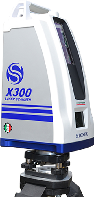
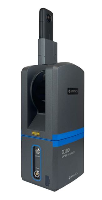
X100 is a small and compact terrestrial laser scanner that is quick and easy to use. Its multi-line lidar technology and ability to achieve complete coverage of the surrounding area enable it to calculate 3D models for a wide range of applications and scenarios, both outdoors and indoors.
The scanner comes with its own X100app field app, making it easy to control the device. Thanks to the scan converter, the data is compatible with Cube-3d and Stonex Reconstructor, as well as third-party software.
The X100 is the perfect tool for quick topographic surveys, scans of building facades and data collection for floor plans; a quick 360° scan takes as few as 45 seconds. The built-in panoramic camera allows you to add true colour to your scans.
X70GO SLAM is a real-time 3D model reconstruction device which integrates inertial navigation module, high performance computer and storage system. It is equipped with a 360° rotating head, which, combined with the SLAM algorithm, generates high-precision point cloud data. A 12 MP visible-light camera provides texture information, while a visual camera guarantees stronger real time preview with GOapp. Mapping results are generated immediately inside the scanner, right after scanning: choose if you want to color them and improve their accuracy, postprocessing with GOpost software.
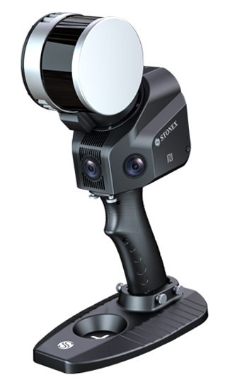
XH120 SLAM is an 3D handheld laser scanner based on STONEX SLAM technology.This powerful scanner allows easy and fast capture of 3D models indoor & outdoor eliminating the need of collecting tens of scans from various stations and of complex multi-cloud registrations. Just move around the scene with XH120 and see the point cloud growing as more data is added in real time. Boost your productivity reducing on site capturing time and post processing workload!
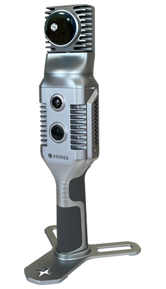
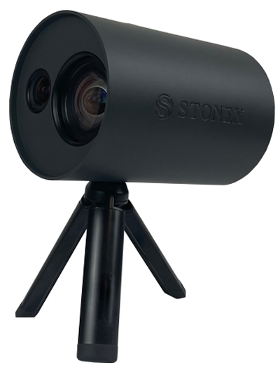
XVS vSLAM 3D SCANNER uses a technology based on the integration of high-resolution images, inertial systems and a complex algorithm: capturing a scenario with XVS, 3D model will be generated through photogrammetric techniques. Walking and capturing the scene in motion, a real-time interface will guide you in the data collection, suggesting the speed of your movement and if necessary returning to an area to have enough image overlapping.
Thanks to Visual SLAM system (Simultaneous localization and mapping), your trajectory is displayed in real-time on a tablet. The Inertial Measurement Unit (IMU) sensor helps the algorithm to generate a continuous image block. The best result will be obtained automatically. Back in the office, the procedure to generate the 3D model is fully automatic, through a desktop PC.Data coming from XVS can be integrated with video from UAV drone or any camera for a complete reconstruction of the area.
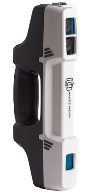
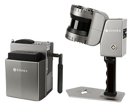
STONEX F6 is the market leader 3D handheld scanner for fast scanning of big objects and large areas from short to far ranges. Based on a patent algorithm of innovative encoding F6 provides superb quality of data making it the ultimate device for scanning complex scenes within seconds.
The F6 is operated by Echo, an advanced and easy-to-use integrated software with high-end features such as:
- Advanced scanning modes with real time feedback
- Powerful 3D data editing tools
- Data quality for controlling distances and accuracies
- Advanced meshing with full color projection
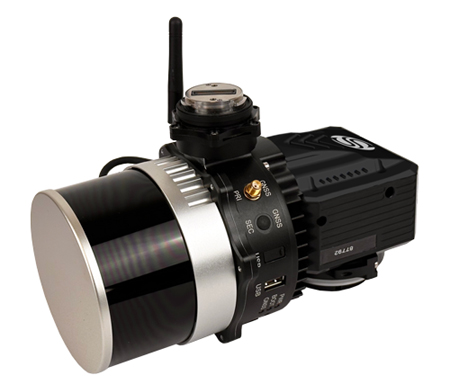
XFLY LIDAR SOLUTION series integrates high performance Inertial Navigation System with camera and LiDAR for point cloud generation. Different customer’s need can be met by the choice of Hesai LiDAR XFLY120, XFLY300 or other sensors.The processing platform contains a Wi-Fi interface, an embedded cellular modem for RTCM corrections, data logging software and a gigabit Ethernet network.Equipped with a high-performance INS, it delivers clean point clouds even at high AGL. As a small, lightweight and low-power system, it allows the user to fly longer, adapting to the needs of any project. The post-processing software provides fully automatic point cloud generation.
INCLUDING VIDEOS AND
BROCHURES DIRECT
FROM THE STONEX
WEBSITE!
CALL (562-426-1306) OR
WRITE FOR PRICING OR TO
ARRANGE A DEMO!!
Cube-3d is a 3D data management software. Draw with CAD tools, create orthophotos and sections, calculate volumes, align models and much more. Using the photogrammetry module, you can generate highly accurate digital maps.
POINT CAB
Thanks to the collaboration between Stonex and PointCab, you can try this powerful software with our Laser Scanners. PointCab Origins is your Swiss army knife when it comes to the evaluation of point cloud data.
RECONSTRUCTOR
STONEX RECONSTRUCTOR SOFTWARE will guide you trough a complete and clear workflow with expandable modules suited to your needs.
STONEX