

GLS 2000/2200 SERIES


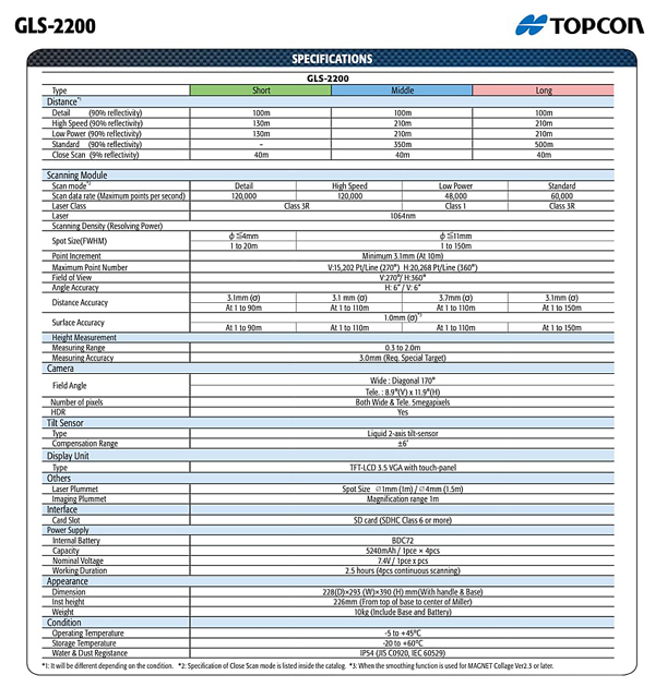
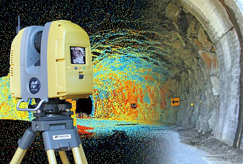
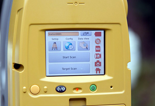
A high-performance scanning solution that’s simple to use. Quickly tackle any job with the latest in scanning and workflow technology. The GLS-2200 features a unique survey style setup and user-friendly processing software that turn lengthy scanning processes into fast and easy workflows
- Unique scanning mode that can capture dense wet concrete data and larger areas
- Get cleaner data with 1mm Plane Fit accuracy through MAGNET Collage
- HDR imaging capability enhances 3D model rendering results
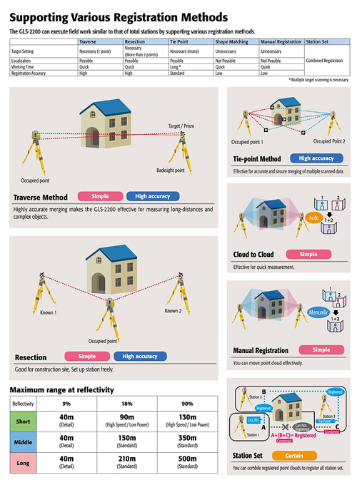
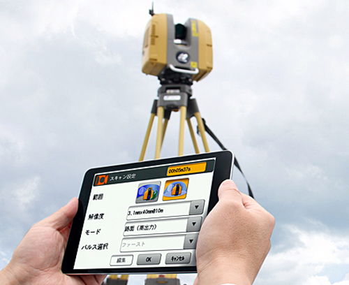
- Surveyor-style setup synchronizes the scanner with the same coordinate system as the design file, reducing post-processing time
- Unequaled 200m setup target range reduces number of setups
- API that allows 3rd party software to directly interface with the scanner for unique industry applications
CALL (562-426-1306) OR WRITE FOR MORE INFO AND PRICING.
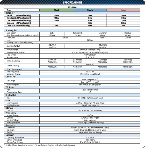
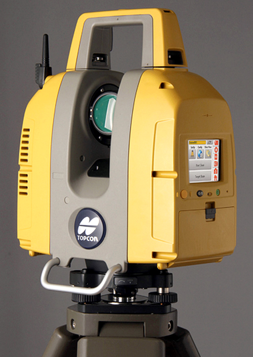
Topcon's GLS-2000 laser scanners allow you to quickly and accurately capture 3D data at any project site. The compact, lightweight scanners accurately and quickly capture your site in less than 3 minutes with a 360° scan, including images.
The GLS-2000 scanner series is composed of three comparable yet distinct models: The GLS-2000S (short range), GLS-2000M (middle range), and the GLS-2000L (long range). Each model is a full-featured scanner that can be effectively deployed to capture as-built conditions for any application range It is the first laser scanner with dual internal cameras and the first scanner with user-selectable laser measurement modes. These innovations, along with class-leading specifications make it an ideal versatile tool to get highly accurate data into any BIM environment.
CALL (562-426-1306) OR WRITE FOR MORE INFO AND PRICING.
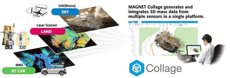
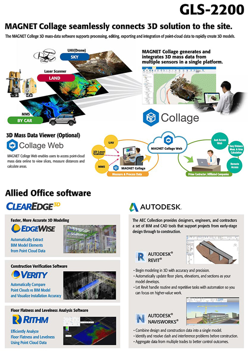
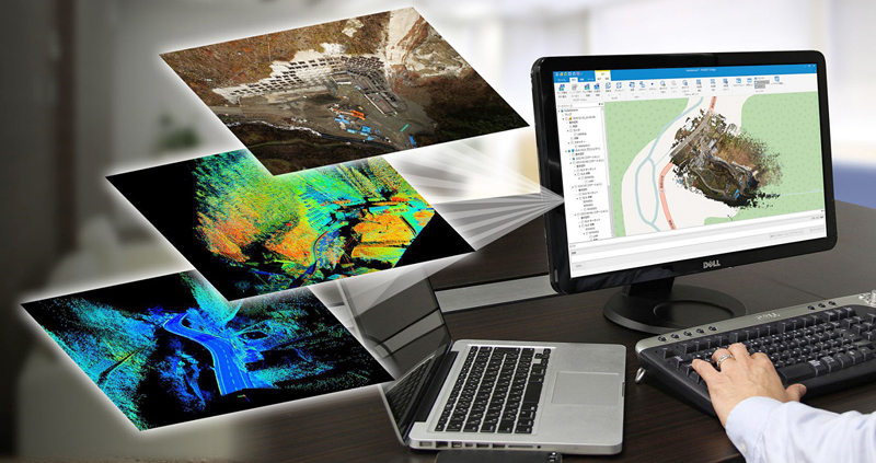
MAGNET Collage provides data processing of otherwise disparate data sets into one 3D environment that can accommodate laser scanner, mobile scanning and mapping, road resurfacing scanners, and photogrammetric point clouds. To further simplify the combination of data, geographic coordinate points from ground control and surveying control can be leveraged for easy matching of point clouds.
FEATURES
- Combine mobile and static scan data into one immersive 3D environment
- Faster point cloud processing and mass data handling
- Combine civil, mapping, BIM, and survey data
- Advanced matching and ground control functionality for a variety of sensors
- Extensive projections and geoids exports
- Segment and reduce point clouds to facilitate import into third-party software
- All-in-one mass data processing software
COLLAGE SOFTWARE BROCHURE